In continuing with the tradition of extending our playoff games across multiple days, we will continue our game against Warren this evening (Thursday, 7/26) at 7:30pm on Field M3 in Warren. We'll start warm ups at 7:00pm -- please arrive a few minutes early so we can start on time. The boys will wear their blue jerseys.
Directions to Warrren from Route 22:
* Rt-22 West to the Warrenville Road traffic light.
* Turn onto Warrenville Road and go up the hill
* Follow Warrenville Road to Mountain Blvd. (Flag plaza/Warrenville Hardware/Kings etc.)
* Turn right onto Mountain Blvd.
* Turn right at traffic light onto Bardy Rd. and follow the road behind the buildings, past the tennis courts and toward the DPW.
* Turn left at the DPW gate and the fields are straight ahead
We will pick up at the point we left off -- Westfield leading 17-11, bases loaded, 2 outs and Scott Tupper at the plate.
Showing posts with label directions. Show all posts
Showing posts with label directions. Show all posts
Thursday, July 26, 2007
Saturday, July 14, 2007
Directions to Berkley Heights for 7/18 Game (Fields are at Early Childhood Center at Hamilton Terrace School)
BERKELEY HEIGHTS DIRECTIONS TO BASEBALL FIELDS at Early Childhood Center at Hamilton Terrace School
TRAVELING 78 EAST:
Get off 78 at Exit 41 (Scotch Plains/Berkeley Heights). Take a left off the exit and travel to traffic light. Turn right at traffic light and travel approximately ¼ mile. Turn left onto Horseshoe Rd. and travel to traffic light. Turn left onto Mountain Ave. and travel about ½ mile. Turn right into The Early Childhood Center (you'll see a white sign on either side of the entrance).
TRAVELING 78 WEST:
Get off 78 at Exit 43 (Berkeley Heights/New Providence). Take a right off the exit onto Diamond Hill Rd. and go through 1st light. At second light take a left onto Mountain Ave. Travel on Mountain Ave. going thru two lights and travel about ½ mile. Turn right into The Early Childhood Center (you'll see a white sign on either side of the entrance).
TRAVELING 22 EAST:
Pass "Sears" on your right and "Blue Star" on your left and get into the right hand lane. Follow signs for Berkeley Heights/New Providence. Turn right immediately after "Snuffy's" and then another quick right going over Rt. 22. Go thru light (the quarry will be on your left after about ¼ mile). Go thru 2 lights. At the third light take a left onto Mountain Ave. Travel on Mountain Ave. going thru two lights and travel about ½ mile. Turn right into The Early Childhood Center (you'll see a white sign on either side of the entrance).
TRAVELING 22 WEST:
Pass "Bowcraft" on your right and travel about 1 mile staying in the right hand lane. Turn right IMMEDIATELY after "McDonald's" and travel about ¼ mile. Turn right at road's end (the quarry will be in front of you). Go thru 2 lights. At the third light take a left onto Mountain Ave. Travel on Mountain Ave. going thru two lights and travel about ½ mile. Turn right into The Early Childhood Center (you'll see white signs on either side of the entrance).
Directions to Chatham (Monday, 7/16 @ 6pm)
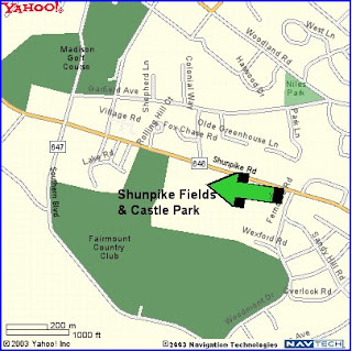
Directions to Shunpike Fields and Castle Park complex in Chatham are as follows...
- -- Take NORTH AVE heading towards Scotch Plains (2.1 miles)
- -- Turn RIGHT onto CR-655 / N MARTINE AVE. Continue to follow CR-655. (0.8 miles)
- -- Turn LEFT onto CR-655 / PARK AVE. Continue to follow CR-655. (2.1 miles)
- -- Turn SLIGHT RIGHT onto MOUNTAIN AVE / CR-622. (0.9 miles)
- -- Turn LEFT onto CR-647 / SOUTH ST. Continue to follow CR-647 (2.4 miles)
- -- Turn LEFT onto SOUTHERN BLVD / CR-647 (2.5 miles)
- -- Turn RIGHT on Shunpike Rd and fields should be on the right (see map)

Thursday, June 28, 2007
Directions to Memorial Field in Scotch Plains
Quick note on the directions to Memorial Field for the games tonight and tomorrow night. If you're on North Avenue and make a right on Westfield Road as if you were heading to Booth Field, you're going to make a right on Westfield Avenue and travel between 1/2 and 1 mile and you'll see Memorial Field on your left. If you're heading west on Plainfield Ave and you pass Scotch Hills on your right, Memorial Field will be a little ways up on your right.
Official Directions...
From Route 22 WEST
Take exit for Scotch Plains, Fanwood, Berkeley Heights, New Providence (about 0.6 miles after you pass Lone Star Restaurant), exit just past McDonalds. Turn left at light onto Route 22 overpass, stay in right lane and bear right at end onto PARK AVENUE (Snuffy's on right). Continue straight up PARK AVENUE to 2nd traffic light. Make a left on to WESTFIELD AVENUE. Continue through one traffic light, the field (MEMORIAL Field) will be up on your left about 4 blocks.
From Route 22 EAST
Take exit for Scotch Plains just past Snuffy's Steakhouse. Continue straight up PARK AVENUE to 2nd traffic light. Make a left on to WESTFIELD AVENUE. Continue through one traffic light, the field (MEMORIAL Field) will be up on your left about 4 blocks.
From Garden State Parkway (GSP)
Take exit 135, Clark/Westfield. {From GSP South, bear right onto Central AVENUE, from GSP North bear left onto circle ¾ around, towards Westfield onto CENTRAL AVENUE}. Shop Rite will be on your right. Continue straight on CENTRAL AVENUE to NORTH AVENUE (next block after passing under railroad tracks). Make a left onto NORTH AVENUE. Make a right onto CLARK STREET (across from Lord & Taylor). Take to end; turn left onto BRIGHTWOOD AVENUE, which turns into PLAINFIELD AVENUE. The field (MEMORIAL Field) will be up on your right just past the golf course.
From Route 78 East
Take exit 41, Scotch Plains/Berkeley Heights. Turn right at end of ramp. Follow signs for Scotch Plains/Route 22; make a right at traffic light onto Plainfield Ave. This will turn into BONNIE BURN ROAD. Follow this road for about 2 miles. Make a right at the 2nd traffic light – going over Route 22. Stay in
right lane and bear right at end onto PARK AVENUE (Snuffy's on right). Continue straight up PARK AVENUE to 2nd traffic light. Make a left on to WESTFIELD AVENUE. Continue through one traffic light, the field (MEMORIAL Field) will be up on your left about 4 blocks.
From Route 78 WestTake ext 41, Scotch Plains/Berkeley Heights. Turn left at end of ramp. Follow signs for Scotch Plains/Route 22 make a right at traffic light onto Plainfield Ave. This will turn into BONNIE BURN ROAD. Follow this road for about 2 miles. Make a right at the 2nd traffic light – going over Route 22. Stay in right lane and bear right at end onto PARK AVENUE (Snuffy's on right). Continue straight up PARK AVENUE to 2nd traffic light. Make a left on to WESTFIELD AVENUE. Continue through one traffic light, the field (MEMORIAL Field) will be up on your left about 4 blocks
July 4th, 6PM Basking Ridge Game Rescheduled
The Basking Ridge game that was originally scheduled for July 4th at 6pm has been rescheduled to Tuesday, July 3rd at 6pm. We will play the game at the Mountain Park complex -- directions are as follows...
It's located just off route 78, near Pingry:
From Route 78:
- 78 west to exit 33 (Bernardsville / Martinsville)
- At end of exit ramp, take left onto Martinsville Road (route 525) and cross back over 78
- Proceed for about 1 mile and make right at light onto Mountain Road
- Park is immediately on the left
Thursday, June 21, 2007
Cranford Tournament website
The Cranford tournament has a website where you can get information on the tournament, including schedules, standings, directions, etc.... Directions to the Cranford fields are also available.
Wednesday, June 20, 2007
North Jersey website
The North Jersey league we compete in has its own website where you can get additional information on the league and current standings. You can also find directions to all fields for our away games.
Friday, June 1, 2007
Directions to Basking Ridge's Mountain Park (7/3 Game)
It's located just off route 78, near Pingry:
From Route 78:
From Route 78:
- 78 west to exit 33 (Bernardsville / Martinsville)
- At end of exit ramp, take left onto Martinsville Road (route 525) and cross back over 78
- Proceed for about 1 mile and make right at light onto Mountain Road
- Park is immediately on the left
Directions to Madison
From I-78
- Start out on I-78
- To NJ-24 West
- EXIT 2A onto Columbia
Turnpike/CR-510 W towards Morristown - LEFT at Park Avenue
- After you pass the
Madison sign, continue, pass South St, next street is Loveland. - LEFT at Loveland St.
- LEFT at East St.
- Parking lot is immediately
to your right, “Hut” field is next to parking lot.
From I-287
- Start out on I-287
- To NJ-24 East
- EXIT 2A onto Columbia
Turnpike/CR-510 W towards Morristown - LEFT at Park Avenue
- After you pass the
Madison sign, continue, pass South St, next street is Loveland. - LEFT at Loveland
St. - LEFT at East St.
- Parking lot is immediately
to your right, “Hut” field is next to parking lot.
From Summit via surface streets
- Morris Ave towards
Chatham/Madison - LEFT on River Rd (go
0.1 mi) - River Rd curves
to the right and becomes Watchung Ave, CR-646 (go 1.0 mi) - Watchung Ave. becomes
Shunpike Ave, CR-646, continue (go 2.0 mi) - RIGHT on Green Village
Rd. (go 0.7 mi), - Turn LEFT onto Main
Street / NJ-124. you are now in downtown Madison (go 0.1 mi) - Road forks, BEAR
RIGHT onto Park Ave. (perpetual green arrow on signal) (go 0.4 mi) - RIGHT at Loveland
St. - LEFT at East St.
- Parking lot is
immediately to your right, “Hut” field is next to parking lot.
Directions to Cranford
Cranford Field Directions
- From the North: Garden State Parkway South to exit 136. Make Right at end of ramp onto Centennial Ave. Go to the 2nd traffic light and make a right into the Centennial Ave Pool Complex. Fields are located near the second parking lot.
- From the south: Garden State Parkway North to Exit 136.Bear left at exit to traffic light. Make a left onto Centennial Avenue. Continue on Centennial Avenue to the second traffic light, make a right into the Centennial Ave pool complex.Fields are at the end of the road, parking on the right.
- From 22 (coming from the west): 22 East to Westfield/Springfield Ave. exit at CompUSA in Springfield. Bear right at exit and continue straight down Springfield Ave. Make right on Springfield Ave. at Nomahegan Park into Cranford (sign). Straight down to the end make a left on North Ave. and quick right onto Centennial Ave. Continue on Centennial Ave to 4th traffic light (Pool Complex) and make another left Fields are at the end of the road, parking on the right.
Subscribe to:
Posts (Atom)


